DAKOTA
|
The Dakota are first recorded to have resided at the source of the Mississippi River during the seventeenth century. By 1700 some had migrated to present-day South Dakota. Late in the 17th century, the Dakota entered into an alliance with French merchants. The French were trying to gain advantage in the struggle for the North American fur trade against the English, who had recently established the Hudson's Bay Company. Relationship with French traders The first recorded encounter between the Sioux and the French occurred when Radisson and Groseilliers reached what is now Wisconsin during the winter of 1659-60. Later visiting French traders and missionaries included Claude-Jean Allouez, Daniel Greysolon Duluth, and Pierre-Charles Le Sueur who wintered with Dakota bands in early 1700. In 1736 a group of Sioux killed Jean Baptiste de La Vérendrye and twenty other men on an island in Lake of the Woods. However, trade with the French continued until after the French gave up North America in 1763. |
|
|
|
|
The Dakota Territory consisted of the northernmost part of the land acquired in the Louisiana purchase in 1803, as well as the southmost part of Rupert's Land, which was acquired in 1818 when the boundary was changed to the 49th parallel. The name refers to the Dakota branch of the Sioux tribes inhabiting the area at the time. Most of Dakota Territory was formerly part of the Minnesota and Nebraska territories When Minnesota became a state in 1858, the leftover area between the Missouri River and Minnesota's western boundary fell unorganized. When the Yankton Treaty was signed later that year, ceding much of what had been Sioux Indian land to the U.S. Government, early settlers formed an unofficial provisional government and unsuccessfully lobbied for United States territory status. Three years later President-elect Abraham Lincoln's cousin-in-law, J.B.S. Todd, personally lobbied for territory status and the U.S. Congress formally created Dakota Territory. It became an organized territory on March 2, 1861. Upon creation, Dakota Territory included much of present-day Montana and Wyoming as well as all of present-day North Dakota and South Dakota and a small portion of present-day Nebraska. Following the Civil War, hostilities continued with the Sioux (like the Dakota War of 1862 and the Red Cloud's War of 1868) until the 1868 Treaty of Fort Laramie. By 1868, creation of new territories reduced Dakota Territory to the present boundaries of the Dakotas. Territorial counties were defined in 1872, including Bottineau County, Cass County and others. With the Great Sioux War of 1876 and the Wounded Knee Massacre of 1890 at last the hostilities between the Sioux and the Americans came to an end, about two-hundred years after the first contact between Indians and Whites. The territorial capital of (American) Dakota was Yankton from 1861 until 1883, when it was moved to Bismarck. The Dakota Territory was divided into the states of North Dakota and South Dakota on 2 November 1889. |
|
|
|
|
|
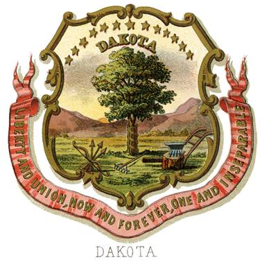
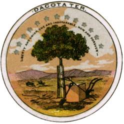
Seal of Dakota Territory The seal of Dakota
Territory represented a tree in the open field, the trunk of which is surrounded
by a corslet of planks; on the right a plow, anvil and sledge; on the left a
bow crossed with three arrows and an Indian on horseback pursuing a buffalo
toward the setting sun; the foliage of the tree arched by a half circle of
thirteen stars, surrounded by the motto,
LIBERTY AND UNION, ONE AND INSEPERABLE NOW AND FOREVER. And in the upper margin: DACOTA TER.[1] The coat of arms
shows the same representation with that difference that the word DAKOTA is
added in chief and the motto is now written on a ribbon surrounding the base
of the shield. [2] Æ See
illustration in the head of this essay |
|
|
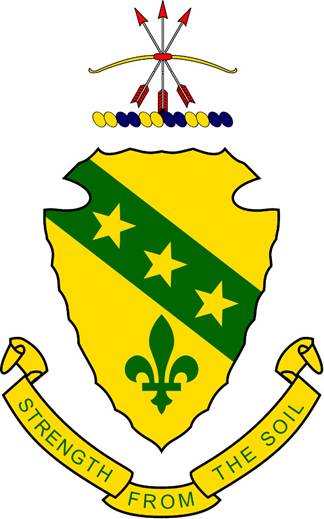
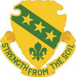
The Arms In the late 1950’s
the National Guard of North Dakota became concerned about the
proriety of displaying as a StatebFlag a design so similar to a regulation
Army color. Therefore a design for a State coat of arms was proposed and
accepted on 15 March 1957 by the legislature with provising for its use on a
flag. The arms are composed of distinctive North Dakota symbols. The colors
green and yellow and the motto are indicative of the State’s agriculture and
livestock. The shield is in the shape of a Sioux arrowhead: the original
inhabitans of the area are represented as well by the bow and arrow in the
crest. On the shield are three stars denoting the executive, legislative, and
judicual branches of the government, and the three nations which have ruled the area.
Three stars also were found of two early explorers of the area, Lord Selkirk
and Meriwether Lewis. The first known European to vist what is now North
Dakota was Pierre Gaultier de Varennes, Sieur de la Vérendreye. The fleur-de-
lys alludes to him.[3]
Arms: Or, a
bend Vert, charged with three mullets of the first and in base a fleur de lys
of the second. Crest: Three
arrows in saltire and a bow per fess, Or and Gules Motto: STRENGTH FROM THE SOIL in green
lettering on a yellow ribbon. Adopted
15.03.1957
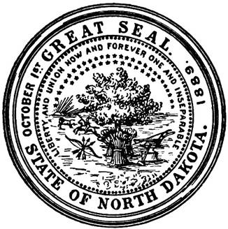
The Seal When Dakota came to be admitted as a State, it was divided into
North- and South Dakota. North Dakota retained the devices of the Territorial
seal, altering the legend, date, and number of stars. Following is its description: “A tree in the open
field, the trunk of which is surrounded by three bundles of wheat; on the
right a plow, anvil and sledge; on the left a bow crossed with three arrows
and an Indian on horseback pursuing a buffalo toward the setting sun; the
foliage of the tree arched by a half circle of forty-two stars, surrounded by
the motto, LIBERTY AND UNION, ONE AND
INSEPERABLE NOW AND FOREVER. the
words ‘Great Seal’ at the top, the word ‘State of North Dakota’at the bottom;
‘October 1st’ on the left and ‘1889’on the right. The seal to be two and
one-half inches in diameter” [4] |
|
|
Police |
|
|
|
|
|
North Dakota State Area Command |
|
|
|
|
|
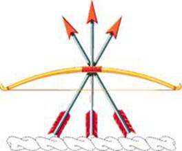
Crest |
|
|
Description That for regiments and separate battalions of the North Dakota Army National Guard: From a wreath of colors, a sheaf of three arrows Argent armed and flighted Gules behind a stringed bow fessways Or with grip of the second. Symbolism The three arrows and the bow are from the seal of the State. Background The crest for the color bearing organizations of the State of North Dakota was approved on 5 January 1924. The wording of the approval was amended on 12 January 1924. |
|
|
Distinctive Unit Insignia |
|
|
Description A gold color metal and enamel device 3.02 cm in height overall consisting of a gold Indian arrowhead point down, bearing a green heraldic bend charged with three five-pointed gold stars, in base a green fleur-de-lis, all above a gold semicircular tri-folded scroll, rolled at the ends and terminating at each side of the arrowhead and inscribed "STRENGTH FROM THE SOIL" in green letters, areas between arrowhead and scroll are pierced. Symbolism The colors of gold and green and the Indian arrowhead forming the shield and the charges on it are taken from the North Dakota coat of arms. Background The distinctive unit insignia was originally approved for Headquarters and Headquarters Detachment and noncolor bearing units of the North Dakota Army National Guard on 16 December 1971. The insignia was redesignated effective 1 October 1982, for Headquarters, State Area Command, North Dakota Army National Guard. |
|
|
Shoulder Sleeve Insignia |
|
|
Description On a blue shield 6.03 cm in width by 6.35 cm) in height, a sheaf of three white arrows armed and flighted red behind a stringed yellow bow with red grip, above a wreath of six twists alternating yellow and blue. Symbolism The three arrows and the bow are from the Seal of the State. The territory was originally a part of the Louisiana Purchase and the twists of the wreath are accordingly, gold and blue. Background The shoulder sleeve insignia was originally approved for Headquarters and Headquarters Detachment, North Dakota National Guard on 3 April 1950. It was redesignated on 30 December 1983, for Headquarters, State Area Command, North Dakota Army National Guard. (TIOH Dwg. No. A-1-171) [5] |
|
|
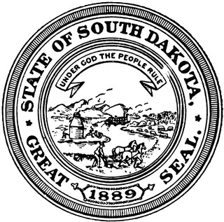
“Seal and Coat of arms. The design of the Great Seal of South
Dakota shall be as follows: A circle within which shall appear in the left
foreground a smelting furnace and other features of minig work. In the left background a
range of hills. In the right foreground a farmer at his plow. In the right
background a herd of cattle and a field of corn.
Between the two parts thus described shall appear a river bearing a steamboat.
Propely divided between the upper and lower edges of the circle shall appear
the legend ‘UNDER GOD THE PEOPLE RULE’ which shall be the motto of the State of
South Dakota. Exterior to this circle and within a circumscribed circle shall
appear in the upper part, the words, ‘STATE OF SOUTH DAKOTA.’ In the lower part the words ‘GREAT
SEAl’
and the date in Arabic numerals of the year in which the State shall be
admitted to the Union.” [6] |
|
|
Police |
|
|
|
|
|
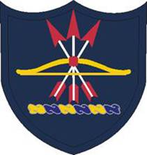
South Dakota Army National Guard |
|
|
|
|
|
Crest |
|
|
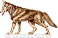
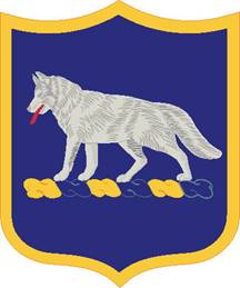
Blazon That for regiments and separate battalions of the South Dakota Army National Guard: From a wreath of colors, a coyote statant Proper. Symbolism The coyote is a native of South Dakota. Background The crest for color bearing organizations of the State of
South Dakota was approved on 21 January 1924. |
|
|
Distinctive Unit Insignia |
|
|
Description A gold color metal and enamel device 2.86 cm in height overall consisting of a gold coyote in front of a black triangle, point up, between and in front of two black partial triangles on each side, the central apex in front of the base of a gold sun, the coyote standing on a blue scroll arched in base, curved in front of the side triangles, terminating in a fold on each side of the sun, and bearing the inscription "LEADERS" on the left, "OF" in base and "THE BEST" on the right, all letters gold. Areas between the scroll, sun and triangle peaks are pierced. Symbolism The coyote from the crest for units of the South Dakota Army National Guard denotes the organization's allotment. The sun is suggested by the State flag of South Dakota and its nickname "The Sunshine State." The black triangles allude to the headquarters location at Rapid City, South Dakota, the chief gateway to the scenic Black Hills. Background The distinctive unit insignia was originally approved for Headquarters and Headquarters Detachment and noncolor bearing units of South Dakota Army National Guard on 2 December 1971. It was redesignated effective 1 October 1982, for Headquarters, State Area Command, South Dakota Army National Guard. The insignia was redesignated effective 1 October 2003, for the South Dakota Army National Guard Element, Joint Force Headquarters and amended to update the description. |
|
|
Shoulder Sleeve Insignia |
|
|
Description A blue shield 7.62 cm in height and 6.35 cm in width with a .32 cm yellow border, charged with a coyote statant Proper on a wreath of yellow and blue. Symbolism The coyote is a native of South Dakota. As the territory was originally a part of the Louisiana Purchase, the twists of the wreath are yellow and blue. Background The shoulder sleeve insignia was originally approved for Headquarters and Headquarters Detachment, South Dakota National Guard on 27 December 1951. It was redesignated for Headquarters, State Area Command, South Dakota Army National Guard on 30 December 1983. The insignia was redesignated effective 1 October 2003, for the South Dakota Army National Guard Element, Joint Force Headquarters and amended to update the description and add a symbolism. (TIOH Dwg. No. A-1-178) [7] |
|
|
|
|
|
Assiniboine tribe (Nakoda) |
|
|
|
|
|
Cheyenne River Sioux Tribe of the Cheyenne River Reservation,
South Dakota |
|
|
|
|
|
Chippewa tribe |
|
|
|
|
|
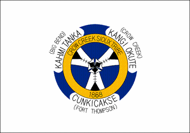
Crow Creek Sioux Tribe of the Crow Creek
Reservation, South Dakota |
|
|
|
|
|
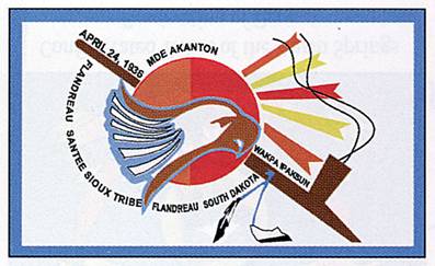
Flandreau Santee Sioux Tribe of South Dakota |
|
|
|
|
|
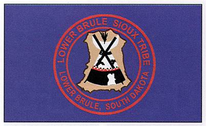
Lower Brule Sioux Tribe of the Lower Brule Reservation,
South Dakota |
|
|
|
|
|
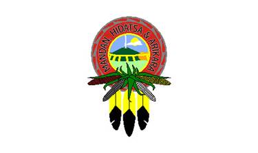
Mandan, Hidatsa & Arikara tribes |
|
|
|
|
|
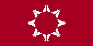
Oglala Sioux Tribe of the Pine Ridge Reservation,
South Dakota |
|
|
|
|
|
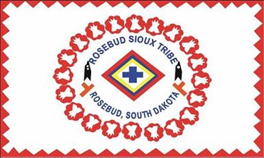
Rosebud Sioux Tribe of the Rosebud Indian
Reservation, South Dakota |
|
|
|
|
|
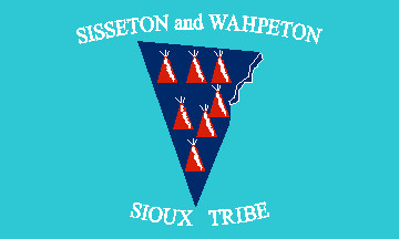
Sisseton-Wahpeton Oyate of the Lake
Traverse Reservation, South Dakota |
|
|
|
|
|
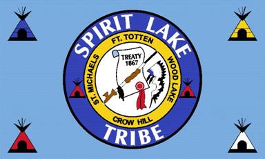
Spirit Lake Sioux Tribe |
|
|
|
|
|
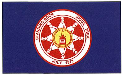
Standing Rock Sioux Tribe of North & South
Dakota |
|
|
|
|
|
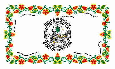
Turtle Mountain Band of Chippewa Indians of North
Dakota |
|
|
|
|
|
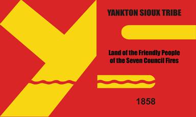
Yankton Sioux Tribe of South Dakota |
|
|
|

 © Hubert de Vries 2016-10-09