MYANMAR
BURMA
Part 4
States & Divisions
|
States and Divisions |
|||||||
|
Myanmar
(Burma) consists of a Union Terriory and 14 provinces divided in 7 states
representing the areas of 7 main ethnic races and 7 divisions. All 7 states
are more or less mountainous, whilst the divisions are mainly plain areas
with the exception of Sagaing, Bago and Thaninthayi divisions |
|||||||
|
|
|||||||
|
Nay Pyi Taw / နေပြည်တော |
|||||||
|
Nay Pyi Taw (Burmese: နေပြည်တော်) is the capital city of Myanmar. It is
administered as the Naypyidaw Union Territory, as per the
Constitution of 2008 � No flag or emblem of Nay Pyi Taw is known yet. |
|||||||
|
Armed Forces |
|||||||
|
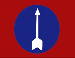
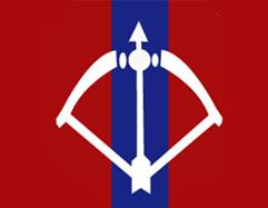
Naypyidaw Command Shoulder Patch The Naypyidaw Command is active in the city. Its headquarters are in Pyinmana |
|||||||
|
|
|||||||
|
The bird
in the white disc is a hornbill (Buceros rhinoceros - Bucerotid�). |
|||||||
|
Armed Forces |
|||||||
|
Western Command Shoulder Patch The Western Command is active in Chin. Its headquarters are in Ann |
|||||||
|
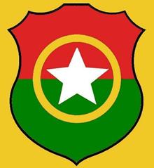
Kachin State Flag The Burmese
government under Aung San reached the Panglong Agreement envisioning the
creation of a Kachin State by the Constituent Assembly. Kachin State was
formed in 1948 out of the British Burma civil districts of Bhamo
and Myitkyina, together with the larger northern
district of Puta-o. Kachin troops formerly formed a
significant part of the Burmese army. With the unilateral abrogation of the
Union of Burma constitution by the Ne Win regime in 1962, Kachin forces
withdrew and formed the Kachin Independence Army (KIA) under the Kachin Independence Organization
(KIO). |
|||||||
|
KIO |
|||||||
|
KIO
flag The Kachin
Independence Organization was established on February 5, 1961 and effectively
controlled the Kachin State (excluding major cities and the railway) during
1960s-1990s until in 1994 a peace treaty was signed, permitting continued KIO
effective control of most of the State, under aegis of the Myanmar military |
|||||||
|
AA Arakan Army |
|||||||
|
The
Arakan Army (AA) was formed in 2009 in the Kachin Independence Army (KIA)
stronghold of Laiza, on Myanmar�s northern border with China, where the
Arakan ethnic rebels received training and arms.
Emblem
Flag |
|||||||
|
KNO |
|||||||
|
KNO Emblem The Kachin National Organization was founded on the 9th of January
1999. The formation was the result of extensive discussion between the overseas
Kachins and the elders from the Kachin homeland. Its main goal is establishing an independent Kachinland.
KNO - flag |
|||||||
|
Armed Forces |
|||||||
|
The KIA was
formed in 1961 in response to the military coup in Burma led by General Ne
Win. From 1961 until 1994, the KIA fought a grueling and inconclusive war
against the Burmese junta. Originally the KIA fought for independence, but
now the official KIO policy goal is for autonomy within a federal union of
Burma. |
|||||||
|
������������������������������ K.I.A. Arms
K.I.A.
Shoulder Patch |
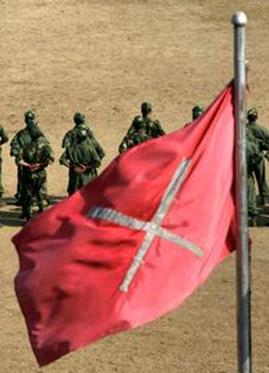
K.I.A.
Flag Although the
ceasefire between the government and the KIA has endured since 1994, general
Sumlut Gun Maw confirmed renewed fighting for independence in the state of
Kachin In 2011 |
||||||
|
Burmese National Army |
|||||||
|
Northern Command Shoulder Patch The Northern Command is active in Kachin. Its headquarters are in Myitkyina |
|||||||
|
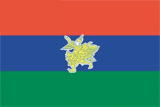
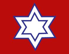
Kayah Flag The
winged being on the flag is a Kanenaree / Kanenayar, a very
gentle mythical bird with human head and torso (to be compared with the
western angel). Also it is a symbol of true love. Kanenaree is a male
and Kanenayar is a female angel. Kayar people believe that they are
decended from kanenaree and kanenayars. |
|||||||
|
Armed Forces |
|||||||
|
Eastern Command Shoulder Patch The
Eastern Command is active in Kayah. Its headquarters are in Taunggyi. |
|||||||
|
Kayin State is also called Karen State. On its
territory and the surrounding territories inhabited by Karen-people an
autonomous Karen state called Kawthoolei was planned after WWII. |
|||||||
|
Kawthoolei |
|||||||
|
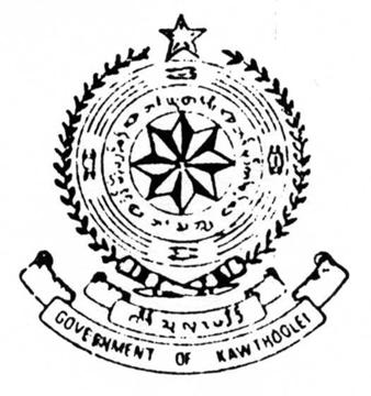
Emblem of Kawthoolei Kawthoolei is the Karen name for the state that
the Karen people of Burma have been trying to establish since the late 1940s.
Kawthoolei as a name is a relatively recent invention, penned during the time
of former Karen leader Ba U Gyi, who was assassinated around the time of
Burma's independence from Britain. |
|||||||
|
History In 1881 the
Karen National Associations (KNA) was founded by western-educated Christian Karens
to represent Karen interests to the British. The majority Buddhist Karens
were not organised until 1939 with the formation of a Buddhist KNA. During World
War II, when the Japanese occupied the region, long-term tensions between the
Karen and Burma turned into open fighting. The Karen
people aspired to have the areas where they were the majority formed into a
subdivision or �state� within Burma similar to what the Shan,
Kachin
and Chin
peoples had been given. A goodwill mission led by Saw Tha Din and Saw Ba U Gyi
to London in August 1946 failed to receive any encouragement from the British
government for any separatist demands. When a delegation of representatives
of the Governor's Executive Council headed by Aung San was invited to London
to negotiate for the Aung San-Attlee Treaty in January 1947, none of the
ethnic minority members was included by the British government. The following
month at the Panglong Conference, when an agreement was
signed between Aung San as head of the interim Burmese government and the
Shan, Kachin and Chin leaders, the Karen were present only as observers; the Mon and
Arakanese
were also absent. The British promised to consider the case of the Karen
after the war. The 1947 Constitution, drawn without Karen participation due
to their boycott of the elections to the Constituent Assembly, also failed to
address the Karen question specifically and clearly, leaving it to be
discussed only after independence. The Shan
and Karenni
states were given the right to secession after 10 years, the Kachin
their own state, and the Chin a special division. The Mon and
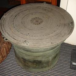
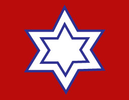
Arakanese of Ministerial Burma were not given any consideration. Flag and Arms The emblem is: Arms:� the
top of a Karen Rain drum decorated�
with an eight-pointed star surrounded by an inscription and four
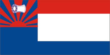
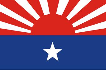
frog-like images. Crest: A five-pointed star Garland: Branches of olive Motto: Kawthoolei in Karen and GOVERNMENT OF KAWTHOOLEI on two scrolls. [1] The flag of Kawthoolei is divided vertically in two
parts 2 and 3, the mast end blue, in the upper half a red rising sun radiant
charged with a yellow rain drum, the free end of three equal breaths red,
white and blue.
Flag
of Kawthoolei
! An extensive article about the Karen drum on:
http://www.drumpublications.org/karendrum.php |
|||||||
|
Karen National Union |
|||||||
|
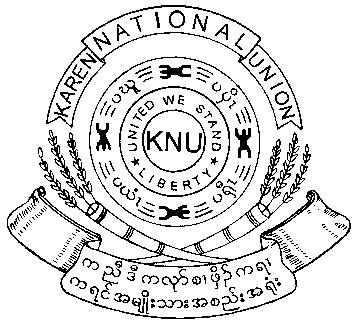
Emblem of the KNU |
|||||||
|
In early
February 1947, the Karen National Union (KNU) was formed at a
Karen Congress attended by 700 delegates from the Karen National
Associations, both Baptist and Buddhist (KNA - founded 1881), the Karen
Central Organisation (KCO) and its youth wing, the Karen Youth Organisation
(KYO), at Vinton Memorial Hall in Rangoon. The meeting called for a Karen
state with a seaboard, an increased number of seats (25%) in the Constituent
Assembly, a new ethnic census, and a continuance of Karen units in the armed
forces. The deadline of March 3 passed without a reply from the British
government, and Saw Ba U Gyi (1905-1950), the president of the KNU,
resigned from the Governor's Executive Council the next day. The emblem of the KNU is derived from the emblem of
Kawthoolei. The flag of the KNU is almost the same as the flag
of Kawthoolei but the stripes in the free end have a proportion of 1, 2 and
1.
|
|||||||
|
Armed Forces |
|||||||
|
In the fall of
1948, the Burmese government, led by U Nu, began an offensive against the
Karen. The Karen National Defence Organisation (KNDO), formed in July 1947,
then rose up in an insurgency against the government. They were helped by the
defections of the Karen Rifles and the Union Military Police (UMP) units
which had been successfully deployed in suppressing the earlier Burmese
Communist rebellions, and came close to capturing Rangoon itself |
|||||||
|
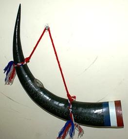
Karen Rifles |
|||||||
|
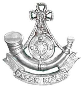
Karen Rifles Horn |
Karen
Rifles Badge |
||||||
|
Karen National Liberation Army |
|||||||
|
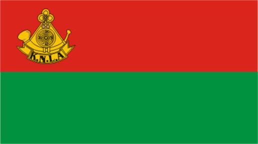
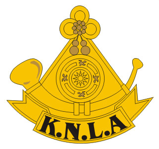
KNLA flag
KNLA
Badge |
|||||||
|
Years later,
the Karen had become the largest of 20 minority groups participating in an
insurgency against the military dictatorship in Rangoon. During the 1980s,
the Karen National Liberation Army (KNLA) fighting force numbered
approximately 20,000. By 2006, the KNLA�s strength had shrunk to less than
4,000, opposing what is now a 400,000-man Burmese army. However, the
political arm of the KNLA - the KNU - continued efforts to resolve the
conflict through political means.
KNLA
Arms
KNLA Flag |
|||||||
|
Democratic Karen Buddhist Army |
|||||||
|
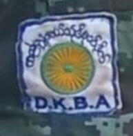
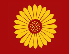
In 1994-5
dissenters from the Buddhist minority in the KNLA formed a splinter group
called the Democratic Karen Buddhist Army
(DKBA), and went over to the side of the military junta. The split is
believed to have led to the fall of the KNU headquarters at Manerplaw in
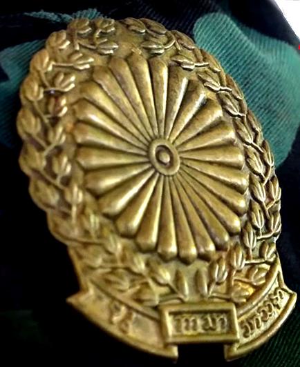
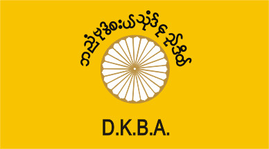
January 1995. The badge of
the D.K.B.A. shows a chrysanthemum-like sun surrounded by a green garland and
with a scroll below. This badge is also on a white square sleeve patch,
surrounded by the name of the organization တိုးတက်သော
ဗုဒ္ဓဘာသာ ကရင်အမျိုးသား
တပ်ဖွဲ့ and the initials DKBA in blue script.
Cap badge
D.K.B.A. flag [2]
D.K.B.A. shoulder patch
Sleeve patch |
|||||||
|
Burma National Army |
|||||||
|
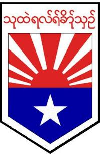
South Eastern Command Shoulder Patch The South Eastern Command is active in Kayin. Its headquarters are
in Mawlamyaing |
|||||||
|
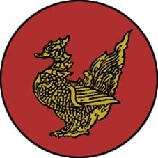
The present flag and seal of Mon State show a golden
hinthar or
Brahminy duck. This form of a duck is believed to have golden feathers, and is able to
fly great distances. It is mated for total monogamy and
great attachment to each other, so much so that if one is killed the other
will not eat until death. It supposedly lives in large flocks. It is a
symbol of the Mon people because they believe that their former capital Bago
was founded on a site where a pair of Hintha had dwelt.
Mon National
Council Banner
Prsent Mon State Flag |
|||||||
|
New Mon State Party |
|||||||
|
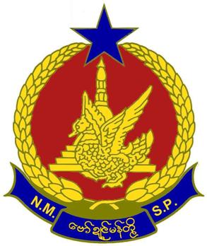
New Mon
State Party (NMSP) was formed in July 1958 under the leadership of Nai Shwe
Kyin (alias) Nai Ba Lwin just after a big surrender under the leadership of
the Mon People�s Front (MPF) which took up armed resistance since 1948. Nai
Shwe Kyin himself was a Central Executive Committee of the Mon People�s
Front. The
emblem of the New Mon State Party is: Emblem: Gules, the Shwedagon Pagoda
charged with a hinthar, wings upwards, Or Crest: A five-pointed� star Azure. Garland: Ears of� rice Or. Motto: N.M.S.P. and New Mon State Party in burmese and in mon-script
Or, on a ribbon Azure. The
golden common shell-drake (Tadorna tadorna - Anseriformes) is the symbol
of the Mons and is known in Mon language as �bob�. Its name in Pali is hamsa/hongsar;
from which comes the derivation Homsavati / Hongsawatoi / Hanthawaddy,
meaning �shell-drake country�. Just like the shell-drake the Mon live on the
shore. Ancient
chronicles tell us that eight years after his enlightenment, Lord Buddha and
his disciples flew over the Southeast Asian continent. On his return-journey,
while crossing the Gulf of Martaban, which happened to be at low tide, he saw
two golden shell-drakes, the duck on top of the drake, sitting on a cape
protruding out of the sea just large enough for a bird�s perch. Seeing the
strange phenomenon he predicted to his disciples that once a country would
come into existence in this vast coastal area where his doctrine would
thrive. About 1500 years after the prediction the region was colonized by
Mons who founded the kingdom of Hongsawatoi / Hanthawaddy (shell-drake country) in 825 A.D.. Shwedagon
Pagoda� is the central and most
important pagoda of the Mon people. The blue
star symbolizes the Pole Star and is the guiding star of the Mon people. Rice is
the main cash-crop of Mon State.
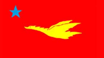
The flag
of the New Mon State Party has a ratio of�
5 � 3. It is red and shows a yellow shell-drake
flying to the mast end and a blue five pointed star in the upper mast-end
corner.� The Red
symbolizes courage and bravery; Yellow
symbolizes glory and nobility; and� Blue symbolizes truth. |
|||||||
|
Armed Forces |
|||||||
|
Shoulder Patch In Mon State the South Eastern Command is active. It has its
headquarters in� Mawlamyaing The Mon
National Defense Organisation (MNDO) was established in March 1948. It
went underground in 1949, led by the Mon United Front (MUF), which in 1952
became the Mon People's Front (MPF). Many Mon rebels surrendered in 1958
while those still active formed the New Mon State Party (NMSP) under the
leadership of Nai Shwe Kyin. The Mon National Liberation Army (MNLA) was
formally founded as its armed wing on 29 August 1971. In 1981, the NMSP split
into two factions, one led by Nai Shwe Kyin and the other by Nai Nol Lar. The
latter faction joined the National Democratic Front (NDF) in 1982. In 1987,
the two factions reunited with Nai Shwe Kyin as the chairman. From 2003 the
new NMSP chairman is Nai Htaw Mon. The last reported commander of the MNLA
was Major General Nai Aung Naing, elected at the NMSP's 6th Central Committee
meeting in 2005. In 2008, Nai Aung Naing split from the MNLA and formed the junta-aligned
Mon Peace and Defence Front (MPDF). The Mon National Liberation Army (MNLA) has the
emblem of the NMSP as a cap badge in full color or in brass. The emblem is
also on a red sleeve patch with inscriptions in white mon and latin script. |
|||||||
|
|
|||||||
|
|
|||||||
|
Arakan reached
the zenith of its power in the Bay of Bengal during the Waithali
(Vesali) (788-1018AD), Lemro and Mrauk U
(1430-1785) periods, but the country steadily declined from the seventeenth
century onwards. Chittagong, which was part of Arakan, was invaded and
occupied by the Mughal Empire in 1666. Internal instability and dethroning of
kings was very common. The Portuguese, during the era of their greatness in
Asia, gained a temporary establishment in Arakan. On the last day
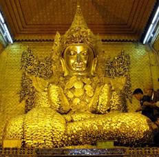
of 1784, the kingdom was finally conquered by the Burmese. The famous Mahamuni
Buddha image was taken as a war trophy by Crown Prince Thado
Minsaw to Amarapura. (The image was relocated to Mandalay by King
Mindon in 1853 when he relocated the capital to Mandalay). The Burmese, after
conquering Arakan, came directly into contact with British interests in east
India. Burmese seizures of Arakan's neighbouring states of Assam and Manipur and the assault
on Shinmaphyu Isle, which was a British outpost in Bengal, were the
instigating causes of the First Anglo-Burmese War (1824-�26). In 1826, Burma
had to cede Arakan and Tenasserim to British India. Arakan was thus one of
the first Burmese territories to be ceded to the British. An 18th century
desciption of Arakan states: �The king's palace is
vastly large; but not so beautiful for its structure; it is supported by
large and tall pillars, made of whole trees, and covered over with gold. The
apartments above are built with red and white ſandal, a� sort of eagle-wood, and other odoriferous
timber. In the� middle of the palace is
a great hall, called the Golden House, because the inside is entirely
overlaid with gold.;� and over the
raised place is fixed a canopy, hung round, with above a hundred kombalenghe,
or large wedges of the ſame metal, in the shape of sugar-loaves, each
weighting above forty pounds. Here likewise are to be seen seven idols, each
the height of a man, cast in gold, two inches thick, and adorned with rubies,
emeralds, ſaphires, and diamonds of an extraordinary size. In the center
of this hall stands a square stool, of three hands-breadth, supporting a
cabinet, both of pure gold, and studded with, precious stones, wherein are
kept the two kanekas, or famous pendants, made in the form of pyramids, of
two- rubies, each of the length of a man's little finger, and. broad at the
base as a hen's egg. These jewels have been the source of bloody wars among
the neighbouring potentates, not so much on account of their value, as that
the prince who possesses them is suppoſed to have a right of dominion
over the rest. This king, however, never wears them but on the day of his
coronation In another apartment of
the palace stands the statue of. the king of Barma, commonly called
Brama, murdered by his subjects, which is made with so great skill as to
raise admiration in the beholders, who are always very numerous, because that
prince was reckoned a great ſaint, and famed for curing diseases,
especially the bloody-flux, on which account they resort to his statue. The government of Arrakan is chiefly in the hands of the twelve princes before
mentioned; who are honoured with the title of kings, residing in the
principal cities, in twelve royal palaces, with each a great seraglio, as well
for their women as thofe they educate for the king of all the
rest, who keeps his court in the city of Arrakan. This monarch affects as
lofty titles as any of his neighbours ; styling himself emperor of Arrakan, possessor of the white elephant (C), with the two Kenekas,
and by virtue of them, rightful heir of Pegu and Brama; lord of the twelve Boyoni of Bengal, and of the twelve kings (meaning those in
Arrakan) who lay the highest hair
of their heads under the soles of his feet. His usual residence is in the
city of Arrakan; but it is customary
with him in summer to spend two months in a kind of progress by water to
Orietan; in which he is attended by his nobility, in boats, so artfully contrived
and disposed, that they appear rather like a floating palace or city, than
what they are. In this progress he does not omit to administer justice ; but
hears causes as regularly as when at land. One pretence for this maritime
journey is to visit the pagod of Quiay Poragray, their supreme deity; to whom
he daily sends a sumptuous dinner. ....... (C) This famous white
elephant was wrested from the king of Siam, by the sovereign of Pegu; in
1567. It was taken by the King of Tangu, at the surrender of Pegu city ; in
1599 and delivered to the King of Arrakan soon after.� [3] |
|||||||
|
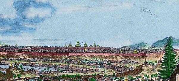
The Royal Palace in Arakan, 1676. On
an engraving entitled d�Coninclyke
Hooftstadt Arrakan in Wouter Schouten�s
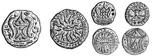
Oost-Indische Voyagie, 1676. The circular emblem on the flag is a picture of a Pyu
coin, minted in the second half of the first millennium AD.
Pyu-coins
|
|||||||
|
|
|||||||
|
Armed Forces |
|||||||
|
Western Command Shoulder Patch In Rakhine / Arakan the Western Command is active.
Its headquarters are in Ann |
|||||||
|
Shan / မိုင်းတႆး |
|||||||
|
The Shans formed
their principality of Mogaung, north of Bhamo in 1215 A.D. The fall of the
First Myanmar Empire of Bagan in 1287 enabled the Shan to establish their
rule over northern Myanmar until 1531 when they were pushed onto the Shan
plateau. Shan hereditary rulers, Sambwas, have officially enjoyed their
traditional privileges until 1959. Previously the region was known as the
Shan States and was divided into the Northern and Southern Shan States. Most
of these became incorporated into the Federated Shan States in 1922. On
Myanmar�s independence in 1948, the Federated Shan States were integrated
with Wa States (bordering with China) to form a state of the Union of Burma. For the history
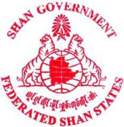
of the Shan see: http://www.taigov.org/history/default.html Seal of the
Federated Shan States The seal of the
Federated Shan States probably dates back to 1922. It shows a globe charged
with the map of the federation supported by two tigers reguardant and crested
by a fivepointed star and an Om sign radiant. The legend reads: SHAN GOVERNMENT and FEDERATED SHAN STATES
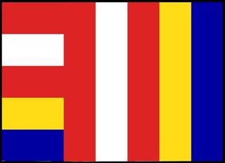
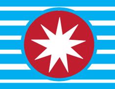
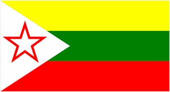
in shan and latin script. Flag of Shan State
1. The design of the national flag was sanctioned at the Panglong
Treaty conference in 1947. 2. The size of the flag is (5ft. � 3ft = 152.4 � 91.4 cm) 3. Diameter of the Moon is (1� ft = 45.7 cm) 4. The breath of the three colors: yellow, green and red (1 ft = 30.48
cm) each. The meaning of the colors: 1. Yellow means religion and race 2. Green means forest, rich in natural resources, people and peace 3. Red means bravery 4. White means purity |
|||||||
|
Shan State ရှမ်းပြည်နယ် |
|||||||
|
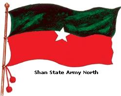
Since the
1960s, Shan State has become one of the centers of insurgent ethnic movements
seeking to gain greater autonomy or a federal status, with some groups aiming
at separation from the Union of Myanmar. The Shan State
Army was established in 1964 by merging the Shan National Front, one of the
largest Shan rebel organizations, with the Shan State Independence Army and
the Kokang Resistance Force. It has since been the main and best organized
Shan rebel force.
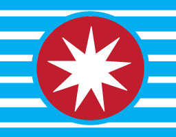
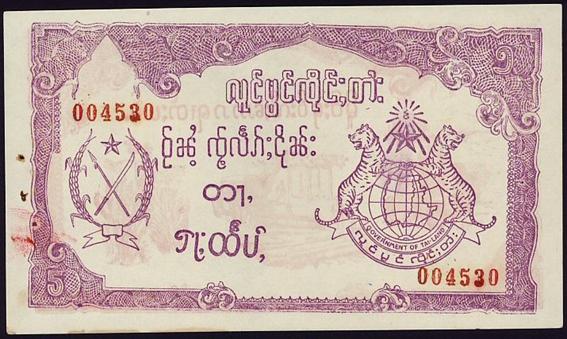
Shan State paper money, 1964-�65. Showing
the emblem of the Shan State Army and the seal of Shan State. |
|||||||
|
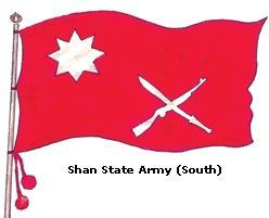
The
emblem of Shan State or Tai-land on this banknote consists of the globe and
the map supported by the two lions and crsed with a star and the Om sign. The
legend on the scroll below reads GOVERNMENT OF TAILAND and the same in
shan-script. The
emblem of the armed forces consist of a spear and a sword in saltire, crested
with a five-pointed star and surrounded by a garland of ears of rice. On April
17, 2005 the Shan State made a Declaration of Independence and the Shan
Government was elected by the people. It uses the flag and the seal of the
first Federated Shan States as depicted above. |
|||||||
|
Armed Forces |
|||||||
|
Shan State,
with many ethnic groups, is the home to several armed ethnic armies. While
the military government has signed ceasefire agreements with most groups, vast
areas of the state, especially those east of Thanlwin river, remain outside
the central government's control, and in recent years have come under heavy
ethnic-Chinese economic and political influence, whereas other areas are
under the control of military groups such as the Shan State Army. |
|||||||
|
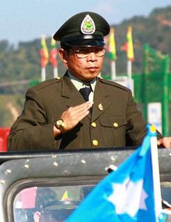
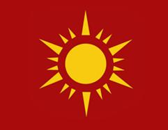
Shan State Army Emblem (ancient) (Gen.
Yawd Serk) |
Shan State Army Emblem (present) |
||||||
|
Shan State Army Cap Badge |
Shan State Army Flag (ancient) |
||||||
|
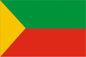
Present Shan State National Army Flag
|
|||||||
|
Burma National Army |
|||||||
|
At the same time three Burma / Myanmar central government commands are
active in Shan State:
1. North Eastern Command which has it
headquarters in Lashio. 2. Eastern Command which has it headquarters
in Taunggyi
Shoulder Patch 3. Triangle Region Command which has it
headquarters in Kyaingtong |
|||||||
|
|
|||||||
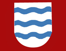
|
Formerly part of Bago / Pegu. The flag shows three
blue waves and the map of the Irrawaddy delta. |
|||||||
|
Armed Forces |
|||||||
|
South Westrn Command Shoulder Patch The South
Western Command is active in Ayeyarwady. Its headquarters are in Pathein (Bassein) |
|||||||
|
For centuries the Mons were known to the Bamars as Talaings,
probably meaning People from Telingana. By the 9th century A.D. the Mons had
been settled in the Ayeyarwady Delta and in the Sittoung valley. (See:
Hanthawaddy Kingdom). After the fall of Bagan in 1287, there was prolonged
struggle for supremacy between the Bamars and Mons which lasted until 1757
when the Mons were defeated by King Alaungpaya. Pegu was annexed by the British in 1852 and renamed
Lower Burma. Mon State was constituted on 3 January 1974 of that part
of Tanintharyi Division comprising the former Mawlamyine and Thaton
districts. |
|||||||
|
Flag and Emblem |
|||||||
|
The Hinta
or Brahminy duck is a symbol of the Mon people who
believe their former capital Bago (= Pegu) was founded on a site where a pair
of Hintha had dwelt. During the 16th and 17th centuries, Bago was Myanmar�s
greatest sea port. Completely destroyed by King Alaungpaya in 1757, it was
partially rebuilt by King Bodawpaya. Pictures of the Hintha bird show duck-like birds but they may be geese
as well as ducks. In the Chinese rank system the goose (Anser) is the
insignia of a civil official of the fourth rank. A Mandarin-duck (Aix
galericulata - Anatin�) is the insignia of a civil official of the
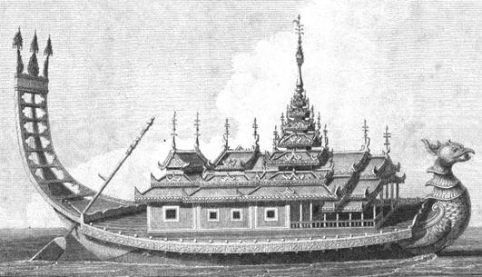
seventh rank. The Shoepaundogee, the Royal Burmese
barge, had the shape of a Mandarin-duck.[4]
The Shoepaundogee, the Royal Golden Barge by Michael
Symes, 1795 An old flag of uncertain origin with a hintha is supposed to be
of the Mon. It is green with a yellow bird and is dated about 1500:
The
Hintha bird based Hantha Thana Throne of Mandalay was made from a kind
of hardwood Thingan sometimes called the Rock Dhamma. This was kept in the
Zaytawun pavilion set behind the Glass Palace. This was also where foreign
dignitaries had their insignia. Probably it was styled after the throne of
the Mon-people.
Present flag of Bago Division |
|||||||
|
Armed Forces |
|||||||
|
Shoulder Patch The Southern Command
is active in Bago. Its headquarters are in Toungoo |
|||||||
|
|
|||||||
|
Armed Forces |
|||||||
|
Southern Command Shoulder Patch In Magwe the Southern Command is active. It has its
headquarters in Toungoo |
|||||||
|
����������������������� The flag of Mandalay
Division shows a picture of the Royal Palace surrounded by a garland of ears
of rice. Amarapura, near
Mandaly, was the residence of the Konbaung Kings 1783-1823 / 1837-�57.
The Royal Palace in Amarapura (Mandalay), 1795 In
the middle is King Bodawpaya ( 1782-1819) on his throne. [5] |
|||||||
|
Armed Forces |
|||||||
|
Central Command Shoulder Patch The Central Command� is active in
the city and has its headquarters there |
|||||||
|
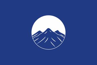
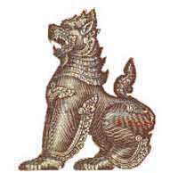
Sagaing is a town in Mandalay Division located on
the bank of the Ayeyarwady River. Sagaing was the capital of a Shan kingdom
in northern Myanmar after the fall of Bagan around 1322 A.D. It served again
as the capital of the Konbaung Dynasty from 1760 to 1764. The flag of Sagaing shows a lion or chinthe.
In Burmese legends, lions are noted for their bravery and are
considered to be the best guardians of religious shrines and edifices. It is common to see statues of lions in front of, or around, the
pagodas in Burma. |
|||||||
|
Armed Forces |
|||||||
|
North Western Command� Shoulder
Patch In Sagaing the North Western Command� is active. It has its headquarters in
Monywa. |
|||||||
|
Flag of Thanintharyi
Coastal Region Command Shoulder Patch In Thanintharyi the Coastal Region Command is active.
It has its headquarters in Myeik. |
|||||||
|
Yangon /
Rangoon |
|||||||
|
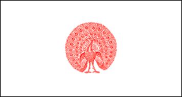
Present flag of Rangoon Division This flag is identical with the flag of the Burmese
kings residing in Yangon (until 29 June 1857). |
|||||||
|
Commissioners of the Port of Rangoon |
|||||||
|
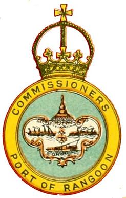
Burma
being administered directly by the British Government, no emblem symbolizing
the Burmese administration was adopted. Nevertheless,
the lower government of the �Commisioners of the Port of Rangoon� (instituted
1880) bore a badge on the red ensign consisting of a blue disc charged with a
frame containing a scene of the Port of Rangoon, surmounted by a the pagoda
of Shwemoktaw, all within a royally crowned yellow bordure with the legend COMMISIONERS PORT OF RANGOON. [6] The
Commisioners were abolished in 1954 and�
has been replaced by the Myanmar Port Authority, founded 1989. This
authority has an emblem of its own: |
|||||||
|
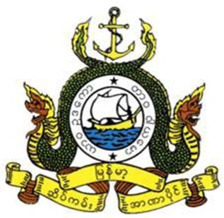
Myanmar Port Authority achievement (after1989) |
|||||||
|
Armed Forces |
|||||||
|
Shoulder Patch In the city the Yangon Command is active. It has its headquarters in Mayangone Township-Kone-Myint-Thar |
|||||||


_no_primeiro_plano_o_bairro_português.jpg)
 � Hubert de Vries